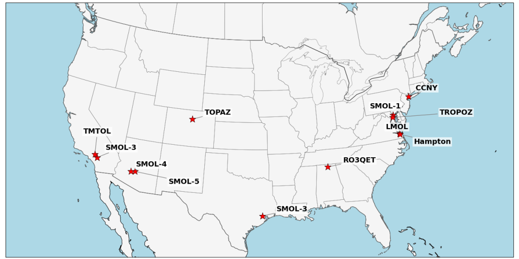
Figure: TOLNet Stations (2026)
The Tropospheric Ozone Lidar Network (TOLNet) is a ground-based observing network designed to bridge the critical observational gap between surface air-quality monitors and spaceborne sensors. Because tropospheric ozone is a harmful air pollutant affecting human and ecosystem health, understanding its vertical distribution is essential in the lower atmosphere where surface stations cannot reach, and satellites lack fine vertical resolution. Using differential absorption lidar (DIAL) technology, TOLNet captures continuous, high spatio-temporal resolution vertical ozone profiles—tracking minute-by-minute and meter-by-meter changes within 5%–10% accuracy day and night—alongside aerosol backscatter and extinction profiles throughout the planetary boundary layer and free troposphere.
Through routine baseline operations and mobile deployments, these observations resolve diurnal boundary-layer evolution and complex land-water coastal gradients while separating locally formed urban pollution from aloft ozone layers driven by long-range wildfire smoke and stratospheric intrusions. In doing so, the network provides foundational ground-truth data to diagnose and improve chemical transport and air-quality forecast models like GEOS-CF, validate spaceborne ozone retrievals from missions such as TEMPO and TROPOMI, and deliver publicly accessible datasets to researchers, air-quality forecasters, and regulatory agencies.
