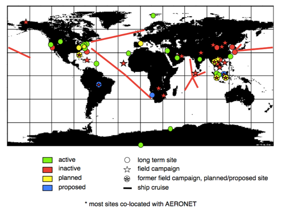
Figure 6: MPLNET Stations
The NASA Micro Pulse Lidar Network (MPLNET) [Welton et al., 2001] is a ground based network of Micro Pulse Lidar (MPL) [Spinhirne et al., 1995] instruments collocated with sun photometers in the NASA Aerosol Robotic Network (AERONET) [Holben et al., 1998]. MPLNET and AERONET are federated networks of instruments designed to collect aerosol and cloud data using standardized data processing algorithms and a central archive and distribution system. MPLNET data provide information on the vertical distribution and properties of aerosol and cloud layers. MPLNET instrument calibrations and Level 1 signal processing algorithms are described by Campbell et al. [2002] and Welton and Campbell [2002]. Level 1 data are acquired at 1-minute temporal and 75-meter vertical resolutions. MPLNET data products also include near-real-time (no quality assurance) Level 1.5 data and final-quality-assured Level 2 data containing layer heights and aerosol properties. The planetary boundary layer height and aerosol top height products are discussed in Lewis et al. [2013] and Campbell et al. [2003], respectively. Thick low cloud heights are determined from derivatives of the Level 1 signal, and high cloud heights are based on Campbell et al. [2008]. The temporal resolutions of the layer products are: cloud (1 minute), PBL (5 minutes), and aerosol (20 minutes). Aerosol products also include profiles of aerosol backscatter, extinction, and aerosol optical depth (AOD), and the column aerosol lidar ratio. Aerosol products are derived using 20-minute, cloud-screened Level 1 III-14 profiles centered on AERONET AOD observation times. The AERONET AOD is used to constrain the retrieval of the aerosol backscatter profile, and compute a final lidar ratio [Welton et al., 2000]. Quality-assured Level 2 MPLNET aerosol products are generated using Level 2 AERONET AOD, profiles of molecular backscatter derived from air density provided by NCEP reanalysis, and the following data screening standards: MPL instrument temperature within 2˚ C of the original optical alignment temperature, a minimum of 16 cloud-free signal profiles during the 20-minute signal average (80%), and derived lidar ratio errors less than 30%. MPLNET Level 2 aerosol products have been validated numerous times. The most recent and comprehensive validation was presented in Schmid et al. [2006], concluding MPLNET Level 2 aerosol extinction profile accuracy within 20%. MPLNET data and more information on the project are available at the MPLNET website.
Campbell, J. R., D. L. Hlavka, E. J. Welton, C. J. Flynn, D. D. Turner, J. D. Spinhirne, V. S. Scott, and I. H. Hwang, Full-time, eye-safe cloud and aerosol lidar observation at Atmospheric Radiation Measurement Program sites: Instrument and data processing, J. Atmos. Oceanic Technol., 19, 431-442, 2002.
Campbell, J. R., K. Sassen, and E. J. Welton, Elevated cloud and aerosol layer retrievals from micropulse lidar signal profiles, J. Atmos. Oceanic Technol., 25, 685–700, 2008.
Campbell, J. R., J. S. Reid, D. L. Westphal, J. Zhang, J. L. Tackett, B. N. Chew, E. J. Welton, A. Shimizu, N. Sugimoto, K. Aoki, and D. M. Winker, Characterizing the vertical profile of aerosol particle extinction and linear depolarization over Southeast Asia and the Maritime Continent: The 2007–2009 view from CALIOP, Atmos. Res., 122, 520-543, 2013.
Holben B. N., T. F. Eck, I. Slutsker, D. Tanre, J. P. Buis, A. Setzer, E. Vermote, J. A. Reagan, Y. Kaufman, T. Nakajima, F. Lavenu, I. Jankowiak, and A. Smirnov, AERONET - A federated instrument network and data archive for aerosol characterization, Rem. Sens. Environ., 66, 1-16, 1998.
Lewis, J. R., E. J. Welton, A. M. Molod, and E. Joseph, Improved boundary layer depth retrievals from MPLNET, J. Geophys. Res. Atmos., 118 (17), 9870-9879, 2013.
Schmid, B., R. Ferrare, C. Flynn, R. Elleman, D. Covert, A. Strawa, E. J. Welton, D. Turner, H. Jonsson, J. Redemann, J. Eilers, K. Ricci, A. G. Hallar, M. Clayton, J. Michalsky, A. Smirnov, B. Holben, and J. Barnard, How well do state-of-the-art techniques measuring the vertical profile of tropospheric aerosol extinction compare?, J. Geophys. Res., 111 (D05S07), 2006.
Spinhirne, J. D., J. A. R. Rall, and V. S. Scott, Compact Eye-Safe Lidar Systems, Rev. Laser Eng., 23, 112-118, 1995. Welton, E. J., J. R. Campbell, J. D. Spinhirne, and V. S. Scott, Global monitoring of clouds and aerosols using a network of micro-pulse lidar systems, in Lidar Remote Sensing for Industry and Environmental Monitoring, U. N. Singh, T. Itabe, N. Sugimoto, (eds.), Proc. SPIE, 4153, 151- 158, 2001.
Welton, E. J., K. Voss, H. Gordon, et al., Ground-based lidar measurements of aerosols during ACE-2: Instrument description results and comparisons with other ground-based airborne measurements, Tellus B, 52, 635-650, 2000.
Welton, E. J., and J. R. Campbell, Micro-pulse lidar signals: Uncertainty analysis, J. Atmos. Oceanic Technol., 19, 2089-2094, 2002.
Updated September 2021, reviewed September 2025