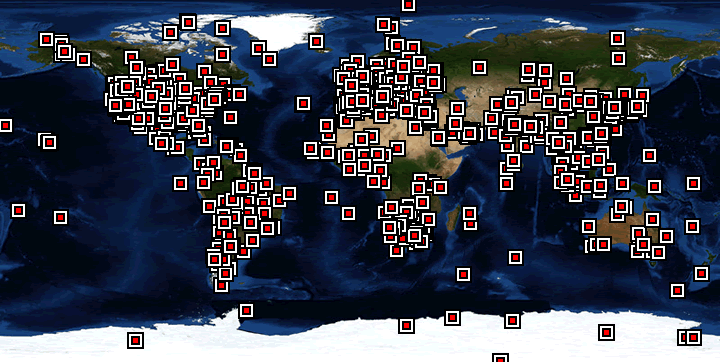
Figure 1: AERONET site distribution in 2014
The AERONET (AErosol RObotic NETwork) Program (Holben et al., 1998) is a federation of ground-based, remote-sensing aerosol networks established by NASA and the University of Lille 1 and is greatly expanded by collaborators from national agencies, institutes, universities, individual scientists, and partners. The Program provides a long-term, continuous, and readily accessible public domain database of aerosol optical, microphysical, and radiative properties for aerosol research and characterization, validation of satellite retrievals, and synergism with other databases. The Network imposes:
- standardization of instruments,
- calibration,
- processing, and
- distribution.
AERONET collaboration provides globally distributed observations at over 500 sites of spectral aerosol optical depth (AOD), inversion products, and precipitable water in diverse aerosol regimes. Aerosol optical depth data are computed for three data quality levels: Level 1.0 (unscreened), Level 1.5 (cloud-screened), and Level 2.0 (cloud-screened and quality-assured). Inversions, precipitable water, and other AOD-dependent products are derived from these levels and may implement additional quality checks.
Holben B.N., T.F. Eck, I. Slutsker, D. Tanre, J.P. Buis, A. Setzer, E. Vermote, J.A. Reagan, Y. Kaufman, T. Nakajima, F. Lavenu, I. Jankowiak, and A. Smirnov, AERONET - A federated instrument network and data archive for aerosol characterization, Rem. Sens. Environ. 66, 1-16, 1998.
Updated September 2021, reviewed September 2025